BatchGeo
4.6
1,097
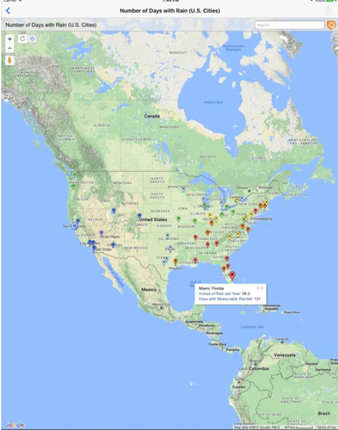
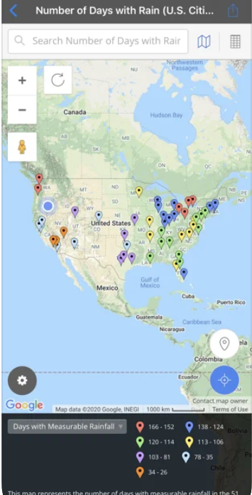
BatchGeo is a SaaS platform that allows users to easily map their list of addresses using spreadsheet, list, or table formats. The platform offers features such as color coding, heat mapping, and optimized routing for up to 23 points at a time. Users can also choose to share their maps publicly or password-protected, and use BatchGeo as a store locator for their website.
Strengths
-
Easy to use
Intuitive interface for creating maps
-
Customizable
Ability to add logos, colors, and other branding elements
-
Collaborative
Multiple users can work on the same map simultaneously
Weaknesses
-
Limited features
Not as robust as other mapping software
-
Limited data sources
Only supports a few file formats for importing data
-
Limited export options
Only exports to a few file formats
Opportunities
- Could integrate with other software to expand functionality
- Could develop a mobile app for on-the-go mapping
- Could add support for more file formats and data sources
Threats
- Other mapping software with more features and functionality
- Market demand for mapping software could decrease
- Increased scrutiny on data privacy could impact usage
Ask anything of BatchGeo with Workflos AI Assistant
http://batchgeo.com
Apolo
Squeak squeak, I'm a cute squirrel working for Workflos and selling software.
I have extensive knowledge of our software products and am committed to
providing excellent customer service.
What are the pros and cons of the current application?
How are users evaluating the current application?
How secure is the current application?
 Sign up for free
Media
BatchGeo Plan
BatchGeo offers a free version with limited features and paid plans starting at $99/year for additional features and increased usage limits.
Free
0
Try BatchGeo out for free, some limitations apply
Maps expire after 30 days of inactivity
Geocoding limited to 1000 per month
Map views limited to 100 total
Pro
99
per month
Get more with Pro
25,000 markers per map
Street View Integration
PDF, PNG, KML Export
25k Views + 250k Geocodes per month
Password Protection
SSO Free Forever
Manage Google Drive, Mailchimp, Dropbox Business, Microsoft PowerPoint, QuickBooks Desktop Enterprise, Canva, Zoho One, DocuSign, Salesforce Sales Cloud Suite, Adobe Photoshop with SSO